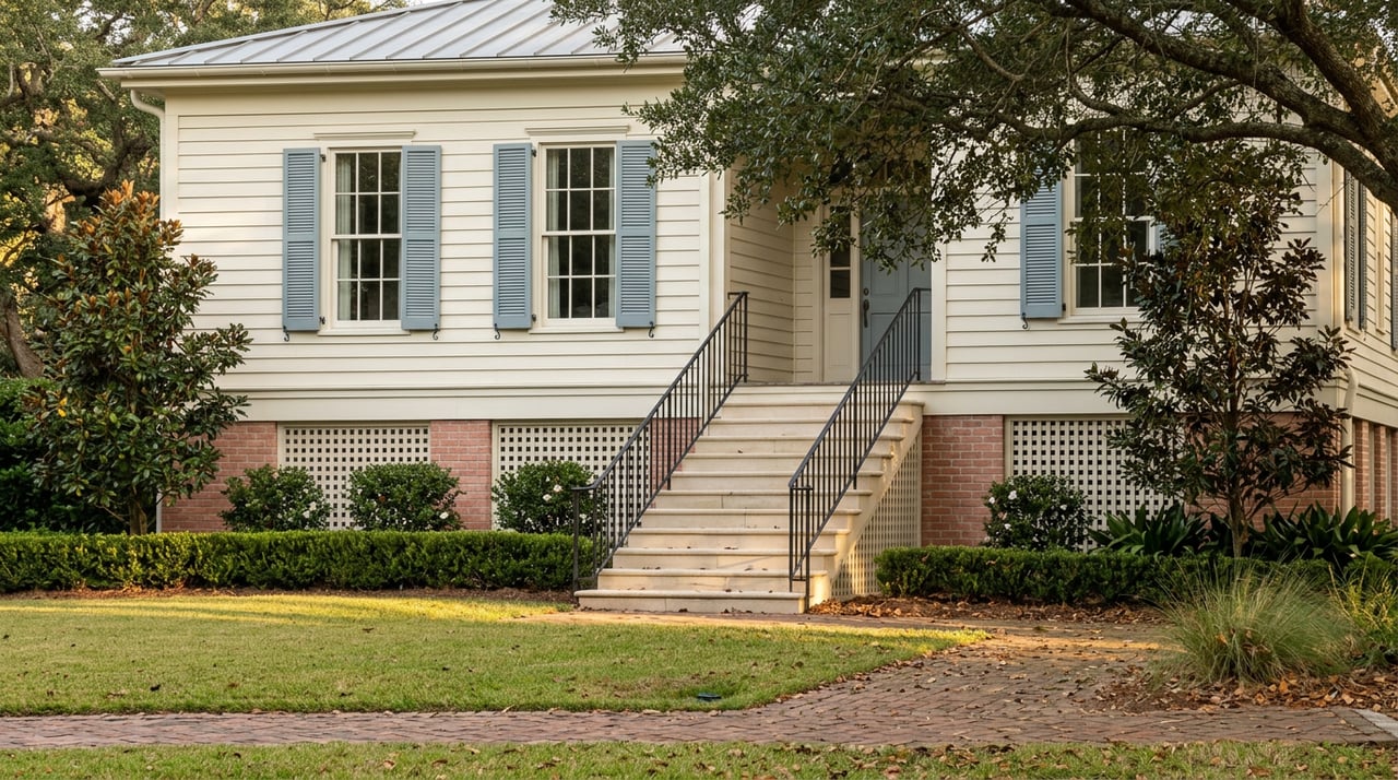
Two listings, filed under the same word. Both went live this summer, both inside greater Covington, both marketed as riverfront within a few miles of each other. One sits on a bluff above the Bogue Falaya that has stayed dry through storms the parish still uses as its own reference point. The other sits closer to the waterline on the Tchefuncte, inside a gated community built within the last decade. The photographs look similar enough to swap. The insurance quotes will not.
That gap rarely shows up in a listing description. It shows up later, in underwriting, after a buyer has already fallen for the view. It is worth understanding before an offer goes in rather than after.
One Word Covering Two Rivers
Covington's broader market has softened enough this year to give buyers room to ask harder questions before committing. As of August 2026, the median list price in Covington sits at $374,000, down 6 percent from a year earlier, with homes spending a median of 107 days on the market. That is slower and cheaper than the same month last year, which means less pressure to skip the due diligence that riverfront property actually requires.
Inside that broader number, "riverfront" is doing two different jobs. Old Covington's stretch along the Bogue Falaya is the historic version of the label: walkable streets, homes built decades before flood maps existed, a downtown corridor where Abita Roasting Co, Meribo Restaurant, and the shops along Boston and Columbia streets sit a few blocks from the water, with the Tammany Trace running through the middle of it. A house on Park Drive sits directly on the Bogue Falaya's banks in the heart of that historic district, the kind of address where riverfront means proximity to a downtown that predates the concept of a flood zone.
The newer version of the label runs along the Tchefuncte, in gated communities built for the amenity of the river rather than the history around it. The Estates at Watercross markets itself on private boat launch access and green space along the Tchefuncte. In that setting, riverfront means a dock and a view first, and a zip code second.
Same word, two rivers, two construction eras, two relationships to the water. Until recently, the insurance system priced them almost identically.
What Changed Underneath the Word
For most of the National Flood Insurance Program's history, premiums followed the flood zone map more than the property itself. If a parcel sat inside a mapped high-risk zone, it paid close to what its zone-mates paid, whether the slab sat two feet above the water or twenty. That changed with FEMA's Risk Rating 2.0 overhaul, which replaced the zone-based model with one that prices each property on its own distance to water, its flood history and frequency, and its individual elevation. The shift was significant enough in Louisiana that roughly 80 percent of the state's NFIP policyholders saw their premiums move under the new system.
That is why a detail that used to read as pure marketing now reads as underwriting. River Club, a gated community along the water in Covington, describes its own land as coveted for its "high ground and location along the river's bow." A decade ago that line was scenery. Under Risk Rating 2.0, high ground is a specific, priced-in number, because the model no longer treats every riverfront parcel inside a shared zone as an equivalent risk. Elevation now sets the premium house by house, not community by community.
That is the real lesson sitting inside the label. Old Covington is not automatically the safer bet, and the newer gated communities on the Tchefuncte are not automatically the riskier one, or the other way around. Within either river, within either era of construction, elevation varies lot by lot. Only an individual elevation certificate says which side of that variation a given house sits on. The neighborhood name says almost nothing.
The Reassurance That Stopped Working in 2016
Buyers often lean on one line of comfort: it is not in a flood zone. That line got harder to trust after March 11, 2016, the date the National Weather Service gauge on the Bogue Falaya near Camp Covington logged as the river's flood of record. The flooding that followed reached thousands of Covington homes that had never taken on water before, and many of those homes sat outside the designated flood zones on the maps in place at the time.
St. Tammany Parish carries the scars of that history in its own numbers. FEMA's case files count more than 400 severe repetitive loss structures across the parish, properties that have flooded and been rebuilt more than once. On the other side of the ledger, the parish's participation in FEMA's Community Rating System currently earns every policyholder in St. Tammany a 15 percent discount on flood insurance premiums, a credit tied to the parish's own floodplain management work rather than to any single property.
"My administration has been demanding information and a delay to the implementation of the program, which could skyrocket flood insurance rates for some of our citizens."
In 2022, as InsuranceNewsNet reported, St. Tammany Parish President Mike Cooper said this as Risk Rating 2.0 phased in and parish officials pushed FEMA for answers. The system stayed. What buyers are left with today is a pricing model that reads water risk more precisely than the old one did, layered on top of a flood history that already proved the old zone lines were never the whole story.
What to Ask Before the Offer
None of this argues against riverfront living. It argues for pricing it correctly before the number gets locked into a mortgage payment. A few questions carry real weight in this particular market:
- Ask for the elevation certificate on the specific structure, not a neighborhood average. It is the document underwriters actually use, and it reflects the lot itself rather than the marketing copy around it.
- Get a live insurance quote for the exact address before finalizing an offer price. Covington flood premiums through the NFIP commonly run $500 to $2,000 a year, but where any single property lands in that range depends on its zone, elevation, and construction, and the only way to know is to ask before, not after closing.
- Compare NFIP and private flood coverage. For lower risk properties sitting in Zone X or holding a favorable elevation certificate, private flood insurance often runs 20 to 40 percent cheaper than the NFIP, though the NFIP remains the more available option for higher risk parcels.
- Confirm the property benefits from St. Tammany's Community Rating System discount. It applies parish wide, but it is easy to miss in a quote that does not itemize where the discount landed.
The Word Tells You About the View
Riverfront tells a buyer what the mornings will look like. It does not tell them what the insurance bill will look like, and those two things are increasingly moving on their own tracks. The house on the historic bluff and the house behind the gate on the newer river both earn the identical word on the listing sheet. Only the elevation certificate and a real quote say which one earns the lower bill.
If you are weighing a riverfront property on the Bogue Falaya or the Tchefuncte and want a clear read on what a specific address is actually pricing in before you write the offer, Puddy Robinson can walk through that comparison with you. Let's Connect.
This article is general information, not legal, tax or financial advice. Consult a qualified professional about your situation.
